Tuesday, August 20, 2013

Headed Home, or Back to the ICW?

Days on cruise:  7

Distance traveled: 83 miles

Travel time:  6 hours

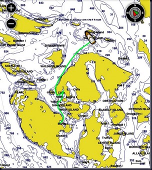
Sunday morning we left Thetis Island under cloudy skies with wind and waves slightly above our comfort level. An hour later conditions calmed, the sun came out, and it became a beautiful day.

photo (13)-001

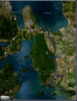
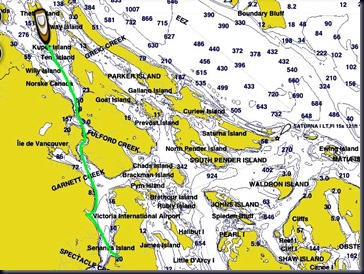
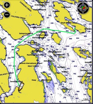
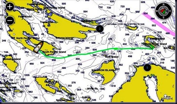
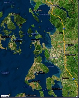
We really wanted to take the shorter distance across the Strait of Juan de Fuca, but kept checking the NOAA forecast, and always found the wind and wave forecasts higher than we prefer, so went east through the San Juan Islands to the north end of Swinomish Channel and down to the charming town of LaConner.

IMG_3089

The Swinomish Channel is one of the very few places in the Pacific Northwest in which travel by boat is somewhat like traveling the Atlantic Intracoastal Waterway (ICW) where we spent more than 1,000 miles last year on the Great Loop.

photo (14)

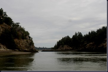
The channel is narrow, shallow, dredged (though not often enough to prevent shoaling, just like the ICW), and attentiveness to the red and green markers is important in order to prevent grounding.

IMG_3097

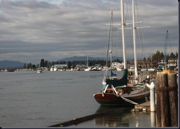
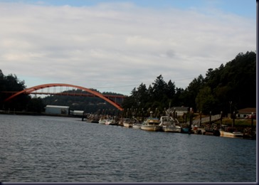
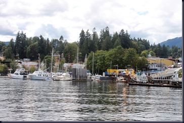
We spent the night at Skagit Municipal Marina ($1.00 per foot during this high season) and ran into Sandy, one of Cathryn’s Book Group friends who was camping nearby with her husband and grand-daughter. LaConner has a number of new buildings, restaurants, winery and brewery outlets for tasting and galleries since we were last here.

IMG_3101

Days on cruise: 8, last day

Distance traveled: 75.4 miles

Travel time: 4 hours, 37 minutes

Monday morning we pulled out of La Conner to travel the second half of the Swinomish Channel at low tide and had a tense half hour during which our depth sounder frequently registered less than 1 foot (beneath our hull), and 2-3 feet most of the rest of the time. It reminded us of times in Biscayne Bay in Florida and Georgian Bay on Lake Huron in Canada. We’re not used to this in the PNW!

IMG_3116

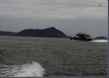
Much to our surprise we were passed by the Victoria Clipper on the east side of Whidbey Island; we thought they always traveled out in the bigger waterways. This boat travels at high speed between Seattle and Victoria, British Columbia.

IMG_3120

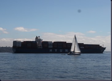
South of Everett we crossed the Puget Sound Shipping Lane, and it was busy with commercial traffic, including this huge Hyundai freighter traveling more than 20 mph (we know because it passed us!)

IMG_3125

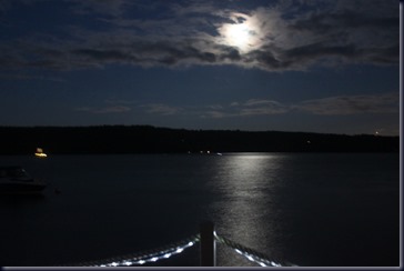
We arrived back home mid-afternoon, and after unloading the boat, starting laundry, and mowing the lawn we relaxed with a late evening glass of wine on the deck, enjoying the almost full moon and its’ moon beams on the water. We had a great trip, and it’s good to be home.
IMG_3132

Saturday, August 17, 2013

Thetis Island–Chemainus

Days in cruise: 6

After a quiet night followed by a morning jog, we left Always Ahead at Thetis Island Marina, walked 15 minutes to the ferry landing, and boarded the small BC Ferry bound for Chemainus on the eastern shore of Vancouver Island.

We spent a day at Chemainus three years ago, and enjoyed wandering the town and looking at the historic murals again. See the post from that trip if interested in details and photos (LINKL

IMG_3082

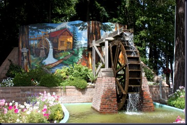
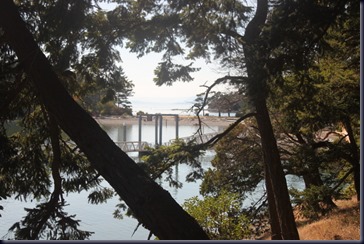
Paddlewheel Park is a shady cool spot with dense, huge cedar and fir trees.

IMG_3083

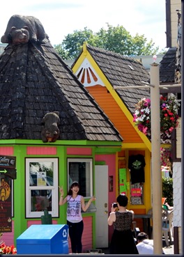
There are lots of tourists in the tiny town of Chemainus this time of year, including the young woman below who danced and posed on the sidewalk for 10 minutes while another man and woman took photos of her.

IMG_3085

At 5:00 we walked to the Chemainus Health Center to meet long-time friends George and Marlene who we hadn’t seen in two years. Marlene has health problems, so now lives in the health care facility, while George bought a new house a few blocks away and visits her several times daily. After a couple hours with both of them, Marlene headed for bed while we went out to dinner with George. It was great to be back in touch after our long time away during our Great Loop trip.

The ferry ride back to Thetis was at 9:00, so our walk back to the boat from the ferry landing would have been n pitch dark were it not for the 3/4 moon providing filtered light through the dense forest of the island.

Friday, August 16, 2013

Thetis Island, Canadian Gulf Islands

Days on cruise:  5

Distance traveled:  32.1 miles

Travel time:  2 hours, 43 minutes

We left Brentwood Bay in leisurely fashion Friday morning, stopped at brand new Mills Cove Marina for fuel, and continued up the west side of Saltspring Island through the strong eddies and turbulence of this narrow, deep stretch to Thetis Island, a place we’ve stayed 3 times previously.

photo (12)

After docking and hooking up to 30amp electricity on the shore power pedestal, our Galvanic Isolator Monitor showed a “failure”message. We asked the dockmaster if a competent “electrical guy” was available on this tiny island, and then Bob went to work to see if he could solve the problem himself, having been told there is someone, but it might be hard to contact him now that it’s the weekend.

IMG_3080

Cathryn (who is writing the first draft of this blog post, and knows Bob won’t likely add many details when he does a final read and edit) describes that he unscrewed some face plates on several “thingys”, disconnected some wires, reconnected and tightened them, did some more, and . . . voila! Problem solved. All this after moving from one spot on the dock to another, thinking there must be a fault in the power pedestal, as we’ve had no problem any previous night on this trip.

Ah, boats! Electrical problems are among the scariest boaters can encounter, as we’ve met one person whose boat burned to the waterline in less than 15 minutes, and another whose electrical connection burned, but “put itself out” without the boat owner finding it, til later. Loose electrical connections can last for years in a house, but on a boat that bangs around on the water, they only get looser and cause problems, mostly over-heating, and causing fires if left unattended.

IMG_3076

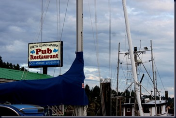
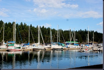
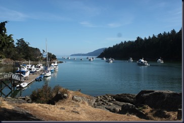
Thetis Island Marina is very pretty, and mostly filled with sailboats. There’s another, “fancier” marina a short distance north in Telegraph Harbor where most of the motor vessels seem to go. We like this one better. We’re still trying to sort through all the “stuff” that separates sailors from motor boaters and don’t always understand it.

IMG_3077

The morning was a mix of clouds and fog, but the sun came out in the afternoon, and it got nice and warm.

IMG_3078

We went for a walk up the hill from the marina and enjoyed a leisurely nap, book reading and chatting with nearby boaters. Does this sound like déjà vu?

Thursday, August 15, 2013

Butchart Gardens

Days on Cruise: 4
Distance traveled:  22.8 miles
Travel time:  1 hour, 35 minutes
Late Thursday morning we continued our westward journey over calm seas, deeper into Canadian waters, then turned south inside the Saanich Peninsula on Vancouver Island to Brentwood Bay Marina.
photo (11)
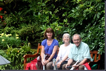
After some boat chores and a walk to the grocery store for re-provisioning, Bob’s sister Lynn and brother-in-law David, who’ve been vacationing at Tofino on the west side of Vancouver Island this week, arrived at our dock. We all last visited Butchart Gardens almost 40 years ago, so thought it time to check it out again.
IMG_3064
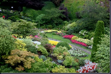
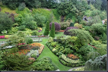
It rained during much of the 2+ hours we walked the 35 acres of gardens, but the Japanese, Sunken, Italian, Rose and Bog gardens were so beautiful, and umbrellas were available, that we were unfazed by the weather.
IMG_3005-001
We wonder at the cost and number of employees or volunteers it must take to maintain this place! The land is still privately owned, but printed information says they have almost 1 million visitors annually, each adult paying about $30 for entry.
IMG_3067
The gardens are over 100 years old, though many of the plantings are changed out periodically or seasonally, according to the brochure.
IMG_3048
Dinner at the pub attached to our marina followed, after which we returned to our boat, and Lynn and David to a hotel in Victoria where they’ll depart by ferry for home early in the morning.
Next destination: Thetis Island, part of the Canadian Gulf Islands.

Wednesday, August 14, 2013

Pender Island, British Columbia, Canada

Distance traveled: 17.8 miles

Travel time:  1 hour, 40 minutes

Today dawned cloudy and calm, so we took off from Sucia Island and headed west, crossing the border into Canada. It was a short trip, and on arrival at Bedwell Harbor we cleared Canadian Customs without any problem.

photo (9)-001

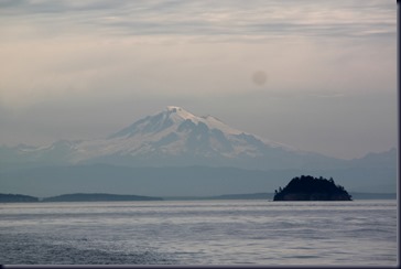
Despite the clouds, the views were spectacular. This is Mt. Baker, a volcano in Washington state, standing 10,781 feet above sea level.

IMG_2981

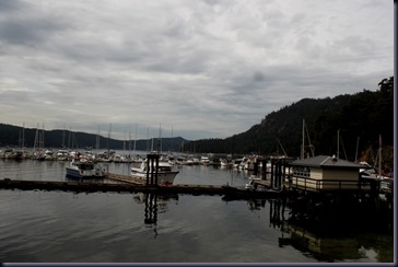
We arrived at Poet’s Cove in Bedwell Harbor on South Pender Island, a very busy Canadian Customs stop seen in the foreground, with Poet’s Cove Marina in the background.

IMG_2989

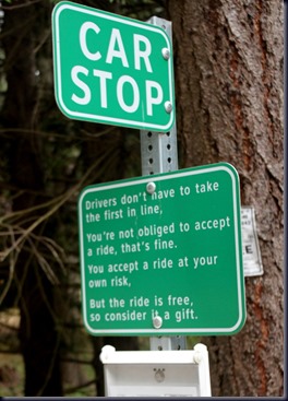
A walk uphill to see what we could find introduced us to “Car Stops”, sort of like bus stops, except there aren’t any buses on this remote island that you can only get to by ferry or private boat. How nice is that, local residents willing to give you a ride from designated “car stops” to other places on the island, all for free? Sweet!

IMG_2990

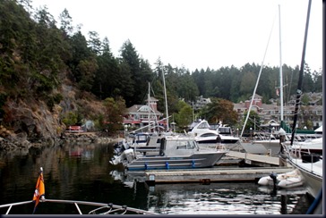
Here we are coming into our slip at the marina, with a huge cliff to our left, rocks underwater nearby, clearly visible, and little room to turn the boat. Our docking wasn’t pretty despite the lack of wind or current, but we made it. Made us miss our more maneuverable twin engines on “Next To Me”.

IMG_2984

This is a lively, pretty place with lots of families staying at the adjacent condos, but quiet because it’s small.

We cooked halibut and edamame for dinner on board.

Tuesday, August 13, 2013

Sucia Island

Days on cruise:  2

Distance traveled:  20.3 miles

Travel Time:  1 hour, 41 minutes

photo (8)

Nice to have a slow start this morning. After sleeping a bit late for us, going for a jog (or must we call it a shuffle when the terrain is so hilly we move even more slowly than usual?) and taking showers at the marina, we took off close to noon, heading north to one of our all-time favorite stops: Sucia Island.  It’s one of the furthest northern islands still in the United States before crossing to the Canadian Gulf Islands.

IMG_2975

Sucia (pronounced Soo-sha) is uninhabited, and owned by the State of Washington as a result of numerous boating organizations (including Bremerton Power Squadron to which we belong) purchasing the island in 1960 and donating it to the State for perpetual use by boaters. There are two docks and 20 or so mooring balls in the most popular, narrow and shallow cove, called Fossil Bay.  We hoped to nab a mooring ball, but all were occupied, so we’re at the dock instead as there’s little room for anchoring given the narrowness of the cove and big tidal swings.

IMG_2977

So we’ve had a lazy day taking a nap, reading books, going on a short walk and chatting briefly with fellow boaters. Life is good.

Cruising again: San Juan Islands + beyond

Distance traveled:  101 miles

Travel time:  6 hours, 43 minutes

IMG_0514

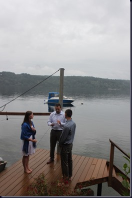
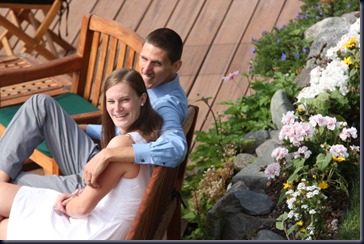
We’re behind on blogging and need to catch up by reporting on our youngest daughter Adrienne’s marriage to Justin (above and below) last weekend, a beautiful and fun event! But that will have to wait until we return home as our photos need more work.

IMG_0665

Yesterday we left for our 7th annual boat trip to the San Juan islands. The first day out, which usually includes a 20-mile open water crossing of the Strait of Juan de Fuca, is usually contingent on the weather forecast, as this 26-foot boat, with this crew, doesn’t do well in seas over 2 feet with winds over 15 knots.

photo (8)

NOAA was forecasting winds 10-20 knots and seas 2-4 feet, subsiding later to 1-3 feet. So we headed up the east side of Whidbey Island intending to go through the Swinomish Channel instead of crossing the Strait. It was overcast but calm on departure.

IMG_2962

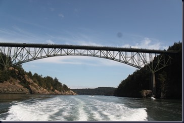
Four hours later on arrival at the Deception Pass Marina where we bought gas and were again awed by the beauty of this place (where we went on one of our early dates 29 years ago), the conditions were so calm we decided to skip the Swinomish Channel, head through Deception Pass and go straight to Friday Harbor.

IMG_2969

We saw dozens of Dall’s porpoises and seals, and lots of gorgeous boats, but no whales for the day.

IMG_2973

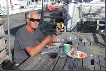
We’d brought 2 dungeness crabs from our freezer at home, so that was dinner on the dock, followed by an evening conversation with another couple from Edmonds who are up here for the week.

Clearly we’re out of practice in packing well for trips such as this: we forgot bath towels, pillows and our SPOT device! We found bath towels at the Friday Harbor drug store but had to improvise on pillows.

We’re happy and well, planning to head to Sucia Island today, then into Canada the next day.

Thursday, August 8, 2013

Check-in/OK message from SPOT Bob and Cathryn

Bob and Cathryn
Latitude:46.83551
Longitude:-121.73193
GPS location Date/Time:08/08/2013 15:02:18 PDT

Message:We are happy, well and having fun.

Click the link below to see where I am located.
http://fms.ws/DJKAF/46.83551N/121.73193W

If the above link does not work, try this link:
http://maps.google.com/maps?f=q&hl=en&geocode=&q=46.83551,-121.73193&ll=46.83551,-121.73193&ie=UTF8&z=12&om=1

Bob and Cathryn

You have received this message because Bob and Cathryn has added you to their SPOT contact list.

Ready for Adventure
FindMeSPOT.com