Wednesday, March 31, 2010

Home Sweet Home

Home, Sweet Home!

IMG_2198

Well, if it weren’t that we’re already busy planning our next road trip in the Arctic Fox, to drive to Alaska beginning the third week of May, we MIGHT be a little sorry we came home so early! We arrived last Thursday and woke up multiple times during the night to the sound of rain pounding on the bedroom skylight. The next day was actually sunny and mild, and Bob was able to mow the lawn, but by Sunday morning the weather deteriorated significantly. We woke at 5am to a completely dark house – the power was out – with high winds and hard rain, even some hailstones.

IMG_2197

Turns out a tree had fallen on the electrical lines on the road coming down the hill to our house. So we lit candles and the fireplace, then got dressed and headed to the YMCA for coffee, exercise, warmth and hot showers. By 10:30 am power was restored. So we’re busy emptying and cleaning the Fox, re-stocking, seeing family, friends and neighbors, and reading Mike and Terri Church’s book on camping in Alaska, among other sources of information. In truth, we’re happy to be home. But Baja was a wonderful place to spend a second winter!

Wednesday, March 24, 2010

Almost Home!

We gathered with Jim and Jan for coffee in our trailer for half an hour this morning, then said our goodbyes. It was wonderful to see them again, and we’re eager to make it work to see them in May on our way to Alaska.

We left Kalamath Falls at 8am and headed west only 90 minutes to our first stop for the day. Our daughter Mackenzie is married to Matt, who grew up in Medford, Oregon. Both of his parents still live there, and we haven’t seen them in quite awhile. We met Matt’s father Bob at a coffee shop at 9:30 and had a nice hour-and-a-half visit, catching up a bit on our travels, his work and other family activities. We then moved on to gas up the truck and pick up Matt’s mother Jeri at her office. We had lunch at a nearby cafĂ© and had more conversation about travels, our kids and family. They’re expecting their first grandchild in Seattle this summer (Matt’s brother and his wife) so we won’t be surprised if we see them in our area more often starting then! It was nice to catch up and we were pleased they could take time out of their busy work days to visit with us.

We left Medford at 1:00 uncertain how far we’d go, and by 5:00 in Corvallis, OR we were tired and ready to pull off I-5. We arrived at our campground under sunny skies with a temp of 70, so spent a very nice hour sitting outside and reviewing the past 3 months, reminiscing about how much fun we’ve had! So this is our last night in the Arctic Fox for awhile.

Tomorrow we’ll be home by mid-afternoon! We can’t wait to see family and friends again and start planning the next adventure to Alaska beginning the third week of May. We don’t generally post to our blog except when we’re traveling, though occasionally a photo or two gets added, but we hope you’ll join us again in May as we drive up through British Columbia and the Northwest Territories of Canada, then into Alaska for our first 6-week trip there. We’ve been getting some great tips on traveling to Alaska from one of our blog readers we’ve never met before. They will be Camp Hosts on the Kenai Peninsula for the summer, so if we get that far, we hope to meet them. It’s wonderful how a blog can bring people together. Happy travels!

Tuesday, March 23, 2010

A Reunion


During 8 hours of driving today we covered only 333 miles – another long enough day. We were on interstate 80 for an hour, and otherwise were on 2-lane winding highways that meandered through less elevation change than yesterday, but still made for slow going. Fortunately, the scenery was mostly beautiful!

winter-lake-tahoe[1]

The highlight of today’s drive was the west shore of Lake Tahoe which Bob had seen before, but was new territory for Cathryn. There was 3-5 feet of snow on the ground, but the road was bare and dry. One highway we’d planned to travel was still closed for the winter season due to snow, so we had to travel 40 miles out of our way on another road, but otherwise the trip was uneventful.

We were on a mission to get to Klamath Falls, Oregon today. For those of you who read our blog during our Baja travels a year ago, you may recall we met a couple, Jan and Jim from Penticton, British Columbia who we ended up traveling with quite a bit of the time because “there’s only one road!” and besides, we liked each other. Jan and Jim didn’t return to Baja this winter, as they spent time in New Zealand in the late Fall, then went to Arizona for the month of February.

IMG_2191

Via email, we learned we were both traveling north through California in the same timeframe and vowed to meet up if possible. Yesterday as we were pulling out of Death Valley and finally got a cell signal again, there were two messages from Jan telling us they were in Redding, California and urging us to join them. We were on the west side of the Sierras instead, but agreed to meet in Klamath Falls this afternoon!

So, we arrived about 4pm to find they’d secured adjacent spots in the campground and spent the rest of today together, a very happy reunion. We talked and talked and talked over beer and appetizers outside our trailers for 3 hours, toured each other’s rigs (both new since last winter) and then went to: where else, but a Mexican restaurant for dinner! We returned to our trailer together for a pre-bedtime cup of tea and more talking, then finally at 9:45 declared it “Baja Midnight” and headed to bed. We had a wonderful time catching up, and agreed to visit them in Penticton on our way to Alaska in May!

IMG_2192

Monday, March 22, 2010

A Roller Coaster Ride

Today we put in 10 hours on the highway, and during that time, gained 17,000 feet of elevation and lost 12,000 feet. No, we were not in Alaska driving up Denali; we were on the east side of the Sierra Mountains in southern and central California! We left Death Valley at 8am and immediately climbed 5,100 feet to the top of Towne Pass, then began a precipitous drop of 3,600 feet, followed by another 4,000 foot climb. The pattern continued throughout the day with gains of 2 – 3,000 feet and drops of similar depth. Our Chevy Silverado 1500 put in a good, hard day, and so did our brakes! Only once did our “Check Engine” light come on, and only once did we stop for a 15-minute break because we could smell our brakes.

We stopped for lunch in Bishop, California at a bakery and lunch deli recommended by our friend Hobie, who has traveled and camped throughout California many times. We had a delicious sandwich and bought a loaf of fresh-baked bread to get us through the trip home.

IMG_2182

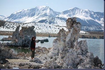
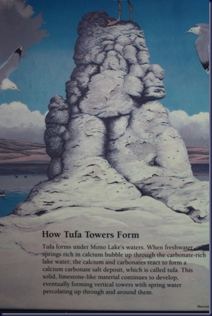
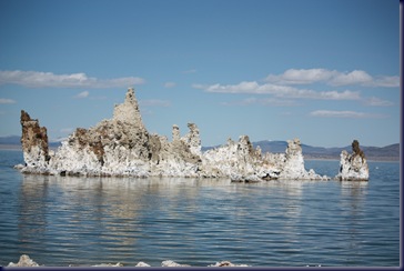
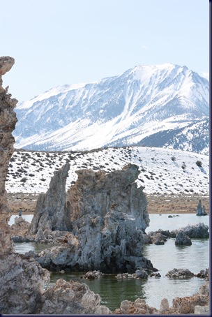
The highlight of the day was a stop at Mono Lake on the opposite (east) side of the Sierra Mountains from Yosemite National Park. Mono Lake is at the foot of a drainage basin which collects water from numerous mountain ranges in the vicinity and has no outlets, so is a “closed ecosystem”. Its’ water is 2.5 times as salty as the ocean, and 100 times as alkaline. The water, though crystal clear, appears blurry, as if oil had been poured into water, the result of fresh water springs that bubble up into the salty lake water. The most astonishing feature is the many formations called “Tufa Towers” which line the shore and spring up from the water’s surface. We’ll let the park signage explaining these formations tell their story.

IMG_2168


The water level in the lake is now more than 30 feet below historic levels, as the City of Los Angeles began draining water from several of its tributaries in 1949. In 1994 an agreement was reached to limit those water withdrawals, and a goal was set to replenish the water level to only 25 feet below historic levels. In the 16 years since, it has not yet achieved that goal. This is significant because the Tufa Towers stop growing when the water level drops below their locations, and the brine shrimp and alkaline flies that are the predominant residents of the lake suffer huge population losses. The area is surrounded by snow-covered mountains that loom as high as 9,000 feet, and today there was snow along the shores of the lake. A beautiful sunny day, though cold enough that Bob donned jeans for the first time since early January when we left home.

IMG_2186

We spent about an hour at Mono Lake, then continued north on Highway 395 which meanders briefly into Nevada, thus leading to our overnight stop in Carson City, where we’re in an RV camp outside a Casino. We picked this one because it has both cell service and internet, two features we lacked access to while in Death Valley. Tomorrow we head into Oregon!

IMG_2185

A Day in the Canyons

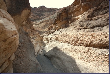
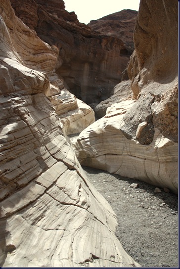
This morning we drove 23 miles north to Stove Pipe Wells and up a gravel road 2 more miles and 1000 feet in elevation. We parked the truck and began a hike up Mosaic Canyon. The first half mile of the hike was an extremely narrow canyon, lined by polished marble.

IMG_2092 

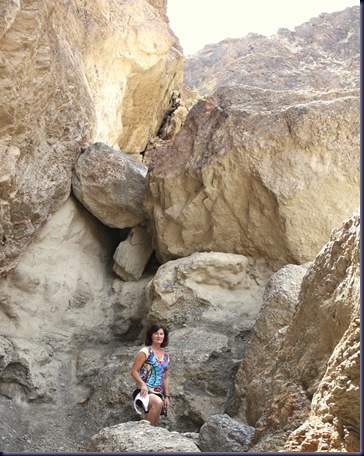
A number of spots required a bit of scrambling, and we admit we missed the high-friction granite on which we’re accustomed to climbing at home and in Baja, as the slick marble is more akin to ice. At one point while Bob was clambering up a short, steep slope and juggling his camera to prevent its’ banging against the rock, he lost his footing and slipped 3 feet. We missed a great photo opportunity: on the slide, Bob hooked his right ring finger on a rock and bent it 45 degrees sideways, at the second joint. What a photo that would have been! Bob yanked the dislocated joint back into alignment, and it’s now swollen, a little sore, and a pale green shade, but frankly we expected worse. Following some ibuprofen and ice, he’s managing just fine as long as Cathryn doesn’t grab it to hold hands.

IMG_2094

We continued up the canyon 2 miles for another 1000’ feet of gain and many great views of sedimentary and other types of rock.

IMG_2102

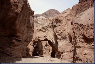
We returned to our campsite for lunch, then traveled 15 miles south to the Natural Bridge. This is a short hike, or walk really, half a mile up a canyon to a natural rock bridge. Unlike the natural bridges we’ve seen at places such as Arches National Park in Utah, this one is made entirely of sedimentary rock. Suffice it to say we walked rapidly while underneath.

IMG_2112

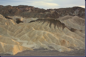
We again returned to our campsite for dinner, then packed a small water bottle with wine and headed up to Zabriskie Point on the east rim of Death Valley to watch the sunset.

IMG_2157

IMG_2158

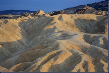
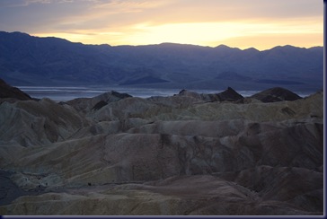
Zabriskie Point is the singular most spectacular site in Death Valley as far as we’re concerned. If you were only going to see one place here, this is it. We saw it last year when we were here with Adrienne and were eager to return. It’s been overcast all day, and as a result the colors in the rocks have not been quite as vivid as they were last year, but it’s still an awesome place.

IMG_2162

We’re headed north tomorrow. Not sure where exactly, maybe Lake Tahoe. Check our SPOT (see the right-hand column) to find out where we end up.

Sunday, March 21, 2010

Back to Death Valley

Last year on our  journey home from Baja, during this same week of March, our daughter Adrienne flew into Las Vegas where we picked her up and traveled to Joshua Tree and Death Valley, California for her spring break. We only allocated 1 ½ days to Death Valley and decided there was too much we were unable to see, so wanted to return to round out our explorations.

IMG_2074

We left Palm Springs under sunny skies and drove 6 hours north, ending with an unsettling descent into Death Valley which included a 17-mile stretch in which the road rapidly loses 5,000 feet of elevation. We recalled our own 2007 experience losing brakes coming down a volcano in Costa Rica, in which we finally crashed the car to prevent going over a cliff instead (with 6 of us inside), as well as our son Ryan’s story about his second set of parents who lost their brakes while driving a motorhome down this same hill into Death Valley some years ago. They eventually stopped when the descent ended after 7 terrifying miles, if we recall the details correctly. So . . . halfway down the slope, Bob pulled to the side and stopped our vehicle for 10 minutes to allow the brakes to cool off before proceeding. We can only imagine how hard the truck’s engine will have to work to pull our Arctic Fox back up that same hill in another day or two! In general, our Chevy 1500 truck and 7000 lb (fully loaded) fifth wheel trailer are pretty well matched, but when it comes to extended uphill grades, that truck works pretty hard!

IMG_2073

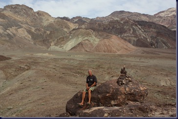
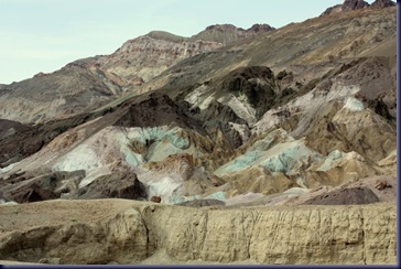
After settling into our campsite at Furnace Creek, we went to the nearby Visitor’s Center for a map of Death Valley National Park and some recommendations about what to see. As it was already late in the day, we went on a drive of the aptly named Artist’s Palette loop, about 9 miles through multi-hued volcanic and sedimentary rock hills. Because of this year’s wet winter in southern California, there’s actually surface water in the usually dry lake-bed. We’re sad to report that for the second year in a row we’ve missed the spring wildflowers. Maybe next time!

IMG_2079-1

After dinner back in our campsite, we returned to the Visitor’s Center to listen to a hugely enthusiastic Camp Ranger Geologist give a talk on the history and geology of Death Valley that included lots of verbal “exclamation points”. It was a story which makes this place all the more astonishing to contemplate.

Tomorrow we’ll do some hiking. Meanwhile, we’re glad we returned.

Friday, March 19, 2010

A Day of Contrasts


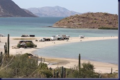
Contrast l: Last Friday we were on Playa Requeson on the IMG_1771

IMG_2050

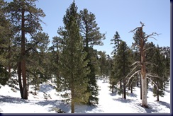
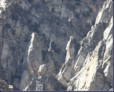
Bahia Concepcion in Baja; today we were at 8,600 feet on Mount San Jacinto in Palm Springs, California. When we left the valley at 10:30am, it was 80 degrees; 10 minutes later it was 45 degrees, and on the north side of the mountain, much colder when the wind chill was factored in. And there was SNOW on the ground! It was just as beautiful as Playa Requeson, but so, so different. The trip up the mountain on the Palm Springs Tramway was great! This tramway claims to have a greater elevation gain than any other in the world. We’ll admit it did feel like there was more exposure than on the tramway up Table Mountain in Cape Town, South Africa which we rode a year and a half ago. There was also a real “bounce and sway” to the car each time it traveled over one of the five towers on the way up. The scenery was spectacular.

IMG_2044

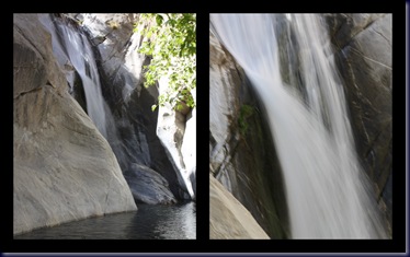
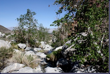
Contrast II: We traveled down from Mount San Jacinto about 1pm and drove 5 miles south to the Tahquitz Canyon Visitors Center on the Cahuilla Indian Reservation. From there, we took a 2-mile hike up to a waterfall at the head of the canyon. This hike through the desert canyon was an amazing contrast to the alpine meadows we’d walked through 7,000 feet above, just hours before. The canyon was gorgeous, filled with beautiful rocks and a burbling stream the whole way up.

2010 baja usa4

Contrast III: We just spent three months living with a mixture of gringo snowbirds (mostly retired married couples, with a smattering of loner men) and very traditional Mexicans, from conservative families to macho men (sometimes a little too macho for Cathryn’s liking). This afternoon we sat in a sidewalk bar on Palm Canyon Drive in downtown Palm Springs and found we were in a distinct minority as straight couple. We just didn’t see many gay folks while in Mexico, so Palm Springs, with a strong gay presence, was an interesting contrast to our experience in recent months.

We tried to sign up for a tour of famous (for their architects, not their owners) mid-century modern homes, but the tours were filled for the next 10 days, as it seems to be spring break here, a detail we’d not anticipated. Instead, we drove our truck around the northwest part of Palm Springs through a gorgeous neighborhood filled with ranch style 1950s and 1960s homes with lovely walled gardens. Very nice.

We enjoyed the day. The contrasts made for interesting conversation while we explored this area. Tomorrow we leave for Death Valley. Should be fun.

IMG_2058

Slab City and Palm Springs: Two Worlds

IMG_2022

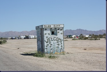
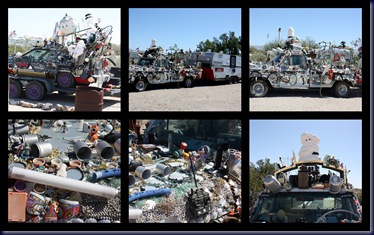
This posting will be heavy on pictures, because pictures really are worth 1,000 words. We went to Slab City today, then left. This is the first time we’ve ever gone someplace, set up camp, then decided to pack up and move on. There are several websites with lots of information about Slab City; use your favorite search engine if you want to learn more as we won’t try to duplicate that information here. But here’s the short version. Slab City is located 5 miles east of Niland, California on the east side of the Salton Sea. During World War II it was a military facility, but was later abandoned. There’s still a dirt road network spread over maybe a square mile, with concrete slabs from buildings long since gone that now serve as the base for some of the camps within the community.
IMG_2005

Why did we move on? Slab City just turned out to be a little too weird, even depressing, particularly for Cathryn, so now that we’ve seen it, we can check it off our list. Lots of people have found Slab City to be fascinating with its outdoor musical events and community centers, and we did too, but it just didn’t grab us. It’s not that we felt unsafe; we just didn’t feel like it was a fit for us as a place to enjoy our time.
2010 baja usa1

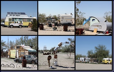
We don’t really know how many folks are in residence at Slab City but would guess at least a thousand. About half of them are like us: retired folks settling in for a few days, weeks or even months during the winter, but with lots of choices in their lives. The other half seemed more like drop outs from the civilized world . . . . some seemed a bit desperate (?), destitute (?), or not connected with society. This is strictly speculation on our part, but we’d guess some portion are receiving a disability check and find Slab City with its’ “no rent and no rules” approach to life a good fit. One of the signs as you enter says “America’s Last Free Place”. We don’t think “free” in this case refers solely to the fact that you don’t have to pay to camp there. While we met lots of “characters” in Baja, this place gave “character” a new meaning.
2010 baja usa

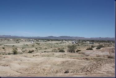
As you see from the photos, the desert location doesn’t offer much in the way of amenities. It’s dry, flat, and desolate. There are no, and we repeat NO amenities; no water, no dump station, no electricity, no garbage collection or pickup. Many of the campers are self-contained (meaning they have their own bathrooms), but we don’t really want to know what the others do for waste disposal, and quite a few of those that appear self-contained have absolutely not moved for years. It’s clear the local building, code and health enforcement folks have determined they’ll not come here.
IMG_2021

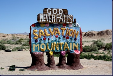
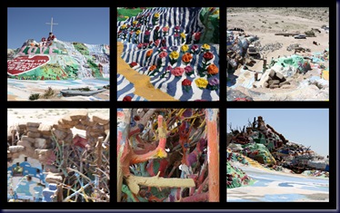
One of the most famous points of interest at Slab City is “Salvation Mountain”. This monument to God is the product of 25 years of work for a man now approaching the age of 80. It’s made up of paint poured over native earth, bales of hay, tires, tree trunks and phone poles. Only photos can describe it.
2010 baja usa3

We loved it. We hated it. We saw it. We moved on.

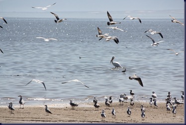
After leaving Slab City, we drove north along the shore of the Salton Sea, an inland body of salt water that is enormous and pretty, framed by tall mountains along the west shore, and another range not far to the east. We’ve heard the Salton Sea is shrinking and suffering lots of environmental problems, but they were not immediately apparent to us today. We did stop, and took a walk into a closed-up Recreation Area. It wasn’t clear if it was closed due to the problems with the Salton Sea or because these are times of financial stress for many California state parks, rest areas and recreation areas due to the State’s budget crunch. We saw several other camp spots along the shore of the lake and considered stopping at one of them, but decided to put in a few more miles toward our destination of Death Valley.
IMG_2031

So we stumbled into another RV park outside Palm Springs. Almost everyone here is a “permanent” resident, meaning they’re snow birds who live in cheek-by-jowl mobile homes that are permanently installed, and spend the winter months of the year here, leaving in the heat of summer when it’s too hot. We’re told temps will be into the triple digits by the end of next month. We’re significantly younger than most of the residents and seemed to be an item of curiosity as we drove in.

We need to do more research to identify camping spots in the U.S. that are a better fit for us, something we succeeded at in Baja, but have not invested the proper amount of time in here. We know we enjoy National and State Parks, but whenever we’re in an area that lacks a conveniently located one, we find we end up somewhere that’s not inspiring, but meets the basic need for a place to park for the night.

So, what did we do once we settled into the RV park? We called our son Ryan, who has a second set of parents living in Palm Desert half the year so he’s been here a number of times, and sought his counsel on activities for tomorrow. We think we’ve come up with an interesting agenda for the day and plan to stay a second night. For this evening, we drove into Palm Springs and spent a couple hours wandering the streets downtown where every Thursday they hold “Village Fest”, a street festival reminiscent of a very high-end cross between the Pike Place Market in downtown Seattle and Pearl Street in Boulder, Colorado. It was a lively event, loaded with folks wandering the booths and shopping for food, art, jewelry, massages, music and watching street performers. It was 75 degrees even at 8pm, so wandering in flip-flops and short sleeves was perfect. The crowd was made up of a cross-section of affluent America . This crowd was about as different from the Slab City residents as you can get.

A sort of weird day.
Wednesday, March 17, 2010

Back in the U.S.A.!

Yet again we were awake early, so sat outside on the shore in our pajamas drinking coffee and watching the sunrise, a nice “final” 2010 Mexico experience! At 8am we hit the road and headed for the U.S. border at Tecate. It was an uneventful road trip and border crossing – 30 minutes from the time we got in line to the time the Customs Agent waved us through after doing only a cursory inspection inside our truck and the Arctic Fox.

We drove east to El Centro, did a replenishment of groceries at Costco, and headed 50 miles north to Bashford’s Hot Mineral Spa 15 miles north of Niland, CA and just east of the Salton Sea so we can do laundry, dump our holding tanks and re-fill our water before heading to a boon-docking location tomorrow. For those of you who saw the movie “Into the Wild”, you may recall a segment in which the main character spent some time on his northbound hitch-hiking journey at Slab City, a funky place you’ll have to Google to believe what it’s about. That’s where we’re headed tomorrow. Bob, who came of age in the 1960s, may feel like a time warp has taken place and he’s re-visiting his youth (only everyone will look, oddly, older!) Cathryn, who came of age in the 1970s may feel it’s a bit like going to a live history museum. We’ll see!
It’s hotter here than any weather we saw in Baja all winter, since last October anyway – sunny and high 80s today. As we’re in a desert, we expect it will still get cold tonight. We sure did enjoy those wide highway lanes today, as well as the opportunity to send a text message to all 3 kids telling them we’re back – it was nice to get quick and welcoming return messages from all 3 of them!

Tuesday, March 16, 2010

Road Trip!

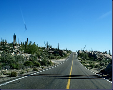
While driving 8 hours is never fun, we must admit today was the least fun we’ve had in a quite a while. We pulled out of Bahia de los Angeles just before 8am under sunny, warm skies with no wind. Looking back, we’re not sure why we left, though we are feeling a bit of “horse back to the barn syndrome” – not so much for getting home to Olalla, but getting back to the U.S., land of wide highway lanes and cell phone service. Actually Mexico has cell service, but we don’t have a Mexican cell phone, and our cell phone plan back home charges $1.50/minute to call the U.S., so we turned ours off January 5 and they haven’t been back on since. We’ve only used Skype.

The drive was variable. During the first 2 hours, the wind was so high that the trailer, and thus the truck, were being blown all over the road, and Cathryn’s hands and head were in a tight knot by the time we left the high, flat plain that allowed the wind to race. We saw one oncoming 18-wheeler get blown off the edge of the road with his back wheels, but fortunately he did not over-correct when pulling back into the lane. Cathryn turned over the wheel to Bob who took the next 4 hours. Including the amazing rock of Catavina

DSC04670


We passed through two Military Checkpoints, and Cathryn had the unpleasant experience of being “bumped” repeatedly (read: felt up) by the guy who was following her around inside the RV directing her to open all the drawers, cabinets and appliances. At the second checkpoint, Cathryn stayed with the truck and let Bob handle the guy doing the RV inspection, our new division of duties at checkpoint! In more than two dozen military checkpoints over the past 15 months, this is the first time anything like this has happened. Cathryn would normally hit or yell at anyone who tried such tricks, but in this case, the guy spoke no English and had an automatic weapon, so she just got angry, kept quiet and got out of the RV as quickly as possible. 62 El Refugio House 2

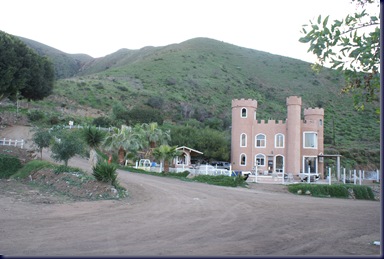
Eight hours, and 294 miles after leaving the last beach, we pulled into Mi Refugio for the night, a campsite on a large estuary just south of Ensenada. We’ve stayed here twice before, and those of you who are long-time readers may recall our mention of the “castle” house with crenellated roof, an outdoor swimming pool (empty this time of year) and pool table. We sat outside and had a beer on the shore and enjoyed our last evening in Mexico.

 63 Refugio  sunrise

Tomorrow morning we’ll drive to Tecate, one of the small, safe, easy border crossings, and enter the U.S.

Monday, March 15, 2010

The Ides of March, 2010

We considered not posting today, as it was “just another day at the beach”, but we’re unsure when we’ll have internet again, so decided to write something brief. The winds died down late last evening, and today dawned calm, with flat water, and nothing but sunshine. Our bodies have not adjusted to the time change from crossing the State line yesterday, so at 5:15 a.m. we were sitting on the beach in our pajamas drinking coffee and watching the sunrise, which came over the horizon only 15 minutes later. All of the campground dogs, and there are MANY, came to say good morning.

We had a run, several hours of reading in our Lafuma chairs in the sun (or at least Bob was in the sun; Cathryn mostly stayed in the shade of the palapa) and a bit of a visit with Mike from California. He was our next door neighbor when we were here last October, and is still here for another month, when he’ll finally head home. While we can’t personally imagine camping on the same beach for 6 months straight, there are LOTS of folks in Baja who do just that, so we may well be out-numbered in our view.

Ron and Francesca, the California couple we’ve camped near several times, came over for cocktails late this afternoon, then we were back to the Arctic Fox for dinner.

Plans change so readily we hate to put anything out there, but we’re thinking we’ll pull out tomorrow morning and head to the San Quintin area for one night, then cross the border either Wednesday or Thursday depending on how our next few travel days go. After 2 ½ months in Baja this winter, and 6 weeks last Fall, we’ll be happy to have wide highway lanes and cell phones again!

Violence in Mexico

You may have read in the news about the American Consulate employee and her husband in Juarez, Mexico who were brutally killed today. We, like you, were saddened by this event and feel great sympathy for those killed and their loved ones. As usual when such events occur, we heard from several loved ones back home telling us the news and urging us to be safe in our travels. We want folks to know how much we appreciate their information, concern and love for us. We want to know what’s going on, we want to be cautious, and we take concerns about safety seriously.

That said, we also have another perspective on the news. Far and away, the vast majority of folks killed in Mexico in such incidents are involved, one way or another, in the “drug trade” – either as cartel members, buyers, sellers or law enforcement personnel. Almost all of such violence occurs in well-known border towns, or other identified areas of mainland Mexico where the cartels dominate the local scene. Information about these “hot spots” is widely available, and we scrupulously avoid such places. Those killed today unfortunately worked in a very dangerous city, and for the U.S. government, which is very active in encouraging and supporting the Mexican government in going after the drug cartels. As a result, those killed today were a carefully chosen target for the cartels which are doing everything they can to preserve their industry.

Because some of the border cities are a center of this type of drug violence, when we cross the border, we pick “easy” crossings, avoiding those that are known for problems. We want to reduce our risk of being “in the wrong place at the wrong time”, so we make sure we have plenty of fuel, water and food, cross early in the morning, and don’t stop until we’re well south of the border.

Additionally, we would note comparisons with violence in the U.S. Since we came to Mexico in January, we’ve read several news stories online about mass killings in the U.S., for example, the professor at the University of Alabama who killed several of her colleagues. We doubt this story made anyone afraid of traveling in the U.S., or even Alabama. There have been other such stories since we traveled south in January.

Even our hometown, Seattle, is a place where we feel very safe. Nonetheless, there are places in Seattle we do not walk the sidewalks at 1am. Last year a mentally ill man entered the downtown Jewish Center and killed several people for no apparent reason. But we don’t think people avoid traveling to Seattle because of fear of violence.

The violence of the drug cartels in Mexico tends to be particularly gruesome, and as a result, is easily sensationalized by the U.S. news media which has become increasingly ”breathless” in its’ approach to news in order to increase its’ audience.

We bring this perspective to all of our travels and attempt to make informed decisions about where to go, when to be there, and what steps to take to heighten or ensure our personal safety. With that in mind, we want you to know that we feel very safe in Mexico and plan to continue our travels in this country in the future. We really appreciate the folks who send us articles or news, statements of love and their concern for our safety as it contributes to “keeping us sharp”.

We will not let fear, fanned by sensational news coverage, dominate our approach to life or travels, and we think knowledge and preparation is the best way to attack fear. Happy and safe travels to all our family and friends, and thank you for your love and concern for us!

Sunday, March 14, 2010

Our Last Beach in Baja

Following an uneventful evening, we pulled out of Guerrero Negro this morning. Four kilometers north of town is the State line separating Baja California Sur from Baja California, and crossing this line includes a change of time zone from Mountain Time back an hour to Pacific Time. We think the U.S. also had Daylight Savings Time change last night, but the changeover here in Mexico is not for a couple of weeks yet, so until we cross the border in a week or less, Pacific Time in the U.S. is one hour ahead of us, and Mountain Time in the U.S. is two hours ahead of us. We’ll try to keep it straight in our heads if we have good internet and try to call any family.

DSC08495

Three hours after our departure, we arrived at Bahia de los Angeles, a place we spent 8 days last October on our southbound leg. It is beautiful, as we remember it. We’re at Daggett’s Fish Camp again, right on the beach, where each spot has its’ own little palapa, but the sites are very close together. There are flush toilets, hot showers, a dump station and garbage service, but no water or electric hook-ups, which is fine with us. We’re extremely happy with our solar panels and can’t imagine using a generator as long as our travel plans take us to sunny climes. We’ll see how that works in Alaska in May and June!

DSC08510

The wind is quite high today, probably 25 mph with stronger gusts, so our afternoon walk to the lighthouse was shortened to only halfway there. Ron and Francesca, the California couple we met a few days ago on Playa Requeson (the spot on the spit) pulled into Daggett’s this afternoon, and we agreed to have dinner together tonight at Larry and Raquel’s, famous for their fish tacos and margaritas. We spent cocktail hour in their rig (more spacious than ours) because of the wind that kept us indoors, then walked next door to Larry and Raquels for dinner.  We had fish tacos, courtesy of Ruth, as Larry is in Ensanada for the time being.  Lots of talk of travels and retired life, so an enjoyable evening. We walked back to Daggett’s by flashlight and called it “Baja Midnight”. We remain happy and well!

Saturday, March 13, 2010

Whale Tails Redux

We set our alarm (always an “ouch!”) this morning to make sure we’d get to the meeting spot for our van ride out to Ojos de Liebre (Eye of the Jack Rabbit) lagoon for a whale watching trip. Last year we went on a trip to see Gray Whales at San Ignacio Lagoon a little further south, but also on the Pacific side. We’ve since heard several people rave about this site, and we’re interested in avoiding the 90-minute drive on a washboard dirt road from last year, so decided to go from Guerrero Negro where we stayed last night instead.

IMG_1957

During the 25-minute van ride, Arturo, our “tour guide” told us all about the city of Guerrero Negro and the Gray Whales in the lagoon, in English. He promised a Spanish version on the return trip for the Mexican folks who made up slightly more than half the clients going out today. Caution: there are lots of numbers in the following paragraph, and we may have gotten some of them wrong, and others may suffer from being run through the local Chamber of Commerce.

IMG_1952

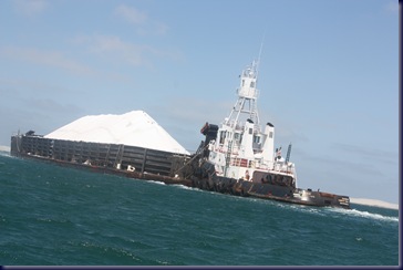
Guerrero Negro is a “company town”. It exists because of the vast lagoon, the largest salt lagoon in the world, which produces almost 60% of the world’s salt supply, including most of that used on the west and east coasts of the U.S. on the snowy winter roads. Jobs with Exportada de Sal, owned 49% by Mitsubishi and 51% by the Mexican government, are the most coveted jobs around. Benefits include great pay, paid housing and utilities, discount groceries at a shop much like the PX stores on U.S. military bases, and new trucks every couple of years for managers. There are MOUNTAINS of salt at the lagoons, and Guerrero Negro even makes the specialized trucks that carry 20 tons of salt to the storage facility which houses 250,000 TONS of salt. There the salt is loaded onto barges which carry 100,000 tons and take it off-shore to a storage facility of 2.5 MILLION TONS that is then loaded into ships to its’ final destination, 55-60% of which goes to Japan for food, metallurgy, agricultural chemicals and other uses.

IMG_1811

Oh yeah . . . we came to see whales, not salt! OK, so at 8:30 a.m. we actually boarded a panga with our boat captain and 7 other tourists including 2 gringos and 5 Mexicans from the mainland. We spent about half an hour moving at a good clip to the mouth of the lagoon. Here we found swells of about 6 feet, and it was quite the ride.

IMG_1825

We began seeing distant whale blows and occasional sightings far away. Another half hour later the density of whales increased, and they were often within 50 feet of our panga, frequently with “mama” and “baby” whales swimming very close together, even touching one another. The sea began to calm a bit, although there remained a steady swell of 2 to 4 feet with some chop.

IMG_1917

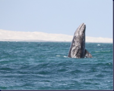
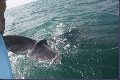
At this point the whales were very close to the boat, and it began to get exciting! Arturo had warned us not to become alarmed if the whales rubbed against the boat, as they would be simply trying to dislodge some of the barnacles that attach to their skin, as you’ll see in the photos. We spent at least 40 minutes with half a dozen whales in very close proximity, a thrilling sight! By the way, none of these photo’s have been cropped. Each one was take with an 18-55 mm lens.IMG_1877

Overall we’d rate Ojos de Liebre equal to last year’s visit to San Ignacio Lagoon. The weather and water conditions were better last year, but we do think there were more whales here then at San Ignacio. It can probably be chalked up to the day-to-day variations that are bound to happen. But as you can see from the pictures, WE SAW SOME WHALES! One fellow in our boat even leaned out far enough to touch one, and said it felt like hard butter. These guys didn’t look incredibly large after our experience with Blue Whales two weeks ago, but somehow looking into the eyes of a whale, any whale, provides a profound experience that’s hard to describe or replicate. Altogether a splendid, memorable day.

IMG_1937-1

Petty Corruption: Chapter 2


We talked to two couples here in the RV camp tonight, and the conversation touched on the military checkpoint north of San Ignacio, where we “donated” a bottle of beer to one of the young men staffing the checkpoint. One of these other couples had been asked if they’d give a bottle of Tequila; the other was asked if they’d donate one of the stuffed animals on their dashboard. Both declined and suffered no repercussions as a result.

We’ve been through this checkpoint three times previously, and other checkpoints up and down the peninsula, and never previously been asked for anything. All we can guess is that it has to do with current crew, not a fixture of the checkpoint culture. We don’t resent one bottle of beer, but are still happy that these other travelers didn’t get any grief for saying “no” to more significant requests.

Friday, March 12, 2010

Sound of Music!

images[2]

Thanks to Jim, a blog reader unknown to us, who commented on our Desperate Times post about Bob’s iPod failure. He suggested Bob needed to give it the “three finger salute”. It worked, and Bob is now happy again! If you’re interested in more details, go back to the post and read under the “comments” section. We also got much appreciated suggestions from Jim in Costa Rica, and Valerie in Seattle that sounded helpful, but Bob tried the three finger salute first, and it worked. It’s great when folks can feel our pain and step up to help. On a related note: during last night’s happy hour, Ron was telling Bob about Sirius radio and their “a la carte plan” with which you can get 50 stations on the satellite radio for $6/month. Sounds like there’s some new technology our future. This should be perfect for our Alaska trip in May and June, and a good fall-back in case of any future iPod failures.

Petty Corruption

Our Garmin GPS tells us we drove 201.8 miles today at an average speed of 42.8 miles per hour – it will track in DSC05714 kilometers instead if we wish, which would make sense here, but we’ve left it on miles. Close to half the distance was uphill through winding mountain terrain, including a 1,400-foot climb of the appropriately named “Cuesta del Infierno” (or “Grade from Hell”) which is actually a little scary going downhill being pushed by a trailer, but just a major gas-eater going up.


The route brought us to yet another Military Checkpoint just north of San Ignacio. Again, we were asked to get out of the truck for inspection and to open the trailer. Bob stayed with the guy inspecting things in the truck, and Cathryn went inside the Arctic Fox with the second guy, carrying on a friendly conversation in Spanish about our 5 children (he saw the family photo on the trailer wall taken the night before Mackenzie and Matt’s wedding, so it includes Matt and Jaime, who he took to be our kids in addition to Ryan, Mackenzie and Adrienne). He opened all the cabinets, and then the refrigerator. On observing the contents of the refrigerator, he said “Oh, you have beer!” Cathryn nodded and acknowledged that we like beer. He said “So do I. Is one for me?” Cathryn thought he was kidding, but said “Yes, if you want one.” He removed one bottle of beer, pulled up his shirt and tucked the bottle into the loose pocket of his pants after looking outside the trailer door to see if any other soldiers might see him! Cathryn was equal parts astonished and amused, as was Bob when she reported the incident after we pulled away from the checkpoint.

Time to Move On

IMG_1761

Gorgeous as Playa Requeson is, and as happy as we’ve been here, after 4 nights it’s time to move north. We’re pulling out this morning to drive to Guererro Negro, a not terribly attractive town near the Pacific side of the peninsula from which we plan to take a Gray Whale watching trip tomorrow. And we’ll have full hook-ups and internet at the campground in which we plan to stay, though our camp book warns that the electrical voltage varies dramatically here and can damage the refrigerator’s circuit board, so we’ll continue to rely on our solar panel for electricity instead.

Thursday, March 11, 2010

Wind, More Clams and Cocktails

IMG_1781

Today was windy. Not just a little, but a lot. We sat outside at 6am with our coffee watching the sunrise, and by 8:30 the wind began to come up. And then it came up some more. By 11:00 Bob wandered inside the Arctic Fox to read, saying he “needed a break from the wind”. The thermometer never broke 70 today, topping out at 69 and very sunny, but chilly because of the wind.

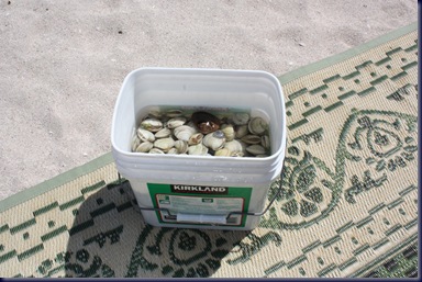
At 1:30, close to peak low tide, we again drove up to Playa Armenta to go clamming. But this time we hit pay dirt, filling our bucket (see photo) with a couple kilos of clams in about 20 minutes! Needless to say we can’t eat that many clams, so we wandered over to a truck on our beach which houses a 30-ish couple (and their 4 dogs) from Alaska who have been kite-sailing in La Ventana since December, and offered them half of our take. They were thrilled and grateful. So were we, as we wouldn’t want to waste all those delicious butter clams.

IMG_1794

Almost half the residents of Playa Requeson have pulled out to head north in the last 2 days, so the beach is starting to look pretty empty. About 2:00 a couple from the L.A. area, Ron and Francesca, drove in and parked next to us. We exchanged greetings, talked briefly and agreed to get together for cocktail hour. They arrived at 5:00 with quesadillas and wine, and we sat outside for 2 ½ hours sharing stories on our lives and travels. He’s an electrical engineer who worked in the satellite development industry, and still does occasional consulting work, so we discussed technology quite a bit, among other topics. Like us, they have 3 kids and are interested in boating, and this is their first Baja RV trip. Cathryn and Francesca took tours of each other’s “homes” to compare the differences between a 21.5 foot 5th wheel and a 28-foot class C motor home. Notably, Cathryn drooled over the amount of closet space they have for clothes, and with a pull-out in the dining area, their place seems quite spacious. Don’t worry we’re not going to by another RV! Altogether a nice evening, after which we cooked our clams for dinner, read awhile and headed to bed.

IMG_1798

Desperate Times


It’s not quite to the point that Bob is ready to hit the SOS button on our SPOT device (see side bar for details) which generates an emergency response, but these are indeed desperate times. Bob’s Ipod stopped working two days ago. We only have one CD in the car, and as much as Bob likes Eric Clapton, it will not be enough. Bob “needs” his music, and is suffering withdrawal.

He’s tried pushing the buttons at 12 and 6 simultaneously to get it to reset, but it won’t do it. Unfortunately the IPod is synced with a desktop in Olalla, so he can’t try that. Anyone have any ideas?

We don’t think this will cause our travels to be aborted, but Bob is no longer quite so happy!

Wednesday, March 10, 2010

Day 3 at Playa Requeson


Last night we both woke about 3am because the Arctic Fox was “rocking”, not due to any activity on our part. Bob, in a middle-of-the-night stupor and based on a previous weather forecast regarding “gale force winds”, worried that high water might come and swamp our campsite, leaving us stuck in the sand in the morning. We both noticed the wind was quite high and had trouble sleeping for a while. By the time we woke in the morning, all was calm, sunny, warm and mild, our middle of the night worries, as usual, for naught. Go figure.

DSC04924

We needed a few groceries and were eager to post to the blog and check email after 3 days without internet, so after our usual morning activities, we loaded up the truck and headed into Mulege, a nice, authentically Mexican town of 3,000 situated on a river a short distance from the coast, and about 25 miles north of our campsite. We attended to various errands, including going to the hardware store to buy WD-40, which for reasons we’ve yet to sort out, is called WB-50 here in Mexico, a fact which led to a brief challenge as Cathryn attempted to make the purchase in Spanish. Mulege still bears some of the signs of last year’s hurricane, including unreconstructed homes along the river, broken date palm trees and a general sense of disrepair, but seems to be functioning normally. We did overhear a gringo at the internet cafĂ© who was consulting the cafĂ©’s owner (who doubles as translator, and offers something vaguely defined as “real estate services”), about the terms and wording of a flood insurance policy he was considering buying. So folks are obviously still feeling vulnerable.

DSC04917

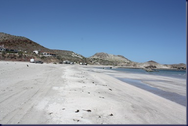
Last winter, and again this year, we occasionally heard folks mention having camped on the beach at a place called Punta Chivato. We’d also heard the rough dirt road, about 20 miles, was difficult to navigate in an RV. So we decided to drive out there today in our truck, sans the Fox. We’re always on the hunt for new places to camp on future trips to Baja. We were pleasantly surprised to find the entire road well-graded, and more than half of it in extremely good condition. The last third of the road was lined with periodic small developments of semi-fancy gringo houses and a dirt airstrip. Punta Chivato itself turned out to be a bare beach – no trees, bushes or protection from the wind – with white sand, some shells, plenty of wind, and very few campers. There was a bit of rock formation along the shoreline that afforded protection for small boats, and it seemed a few of the campers keep their boats on buoys for fishing and other water activities. We had a picnic lunch we’d brought along, walked the beach and talked briefly to a few folks. It made for a nice excursion and checked off one of the places we were interested in seeing, but the journey didn’t make us want to camp there.

IMG_1784

After filling our four 5-gallon water jugs back in Mulege on the return trip to Playa Requeson, we went back to our trailer, had a brief siesta followed by a margarita on the beach, dinner, and spent some time sitting by our beach fire and watching the stars. Life continues to be good!