Friday, May 21, 2010

Our First Day as Tourists: Hyder, AK, and Stewart, B.C.


We drove a total of 50 miles today and ended up at the same place we started, the Bear River RV Park in Stewart, B.C. Our tour consisted of driving a couple miles through Stewart and Hyder, starting in B.C., then entering AK.


We then drove 23 miles of countryside, beginning in AK and turning around to re-trace our steps in B.C. During this drive we began at sea level in 50 degrees and reached 3500 feet elevation and 37 degrees in mixed rain and snow.


During our drive we saw wetlands named Moose Pond (where only beavers and bear appear, not Moose – go figure!), wandered the boardwalk adjacent to Fish Creek, then drove along the Salmon River valley, a half-mile-wide braided river channel fed by glacier melt water, and finally arrived at the Summit Glacier. As you can see, the pattern of “place names” here is mostly pretty basic.


This area has not really opened yet for the summer season. We were told that quite a few folks will arrive over the Memorial Day weekend, then it will be quiet again until July and August when the salmon are running and the crowds will appear. At this point the area will be inundated by fishermen, bears, and people hoping to witness the large number of grizzly and black bears feeding along the Fish Creek.


This was a great relaxing day. We’ll let the pictures tell the story. We suspect the landscape will seem somewhat unremarkable by the time we’re headed home. But it’s beautiful by any objective standard and a wonderful break from the previous 4 days since we hit the road and put lots of miles behind us.

One little piece of personal news. Bob’s pain meds are doing a great job helping him manage the discomfort, and we’re optimistic he’ll be able to cut back much more rapidly than we could ever have imagined yesterday. Tonight he might even get a good night’s sleep! Thank you Dr. Kevin.


Thursday, May 20, 2010

A Day of Firsts


 first fox

first experience with Canadian healthcare system

first moose

first glacier

first stop in Alaska

While having coffee in our Lake Burns campsite this morning we noticed movement out the window and realized we were seeing FOUR foxes, with bushy white-tipped tails scavenging through the campground peeing on the trees and looking for food. They hung around for 15 minutes racing from spot to spot. We took some photos, but it was still darkish dawn and raining lightly, so none turned out.

Right after the foxes left the area, Bob sneezed. While some folks think we occasionally go into too much detail on our blog, we wouldn’t normally report a sneeze. However in this case the sneeze resulted in some changes to our trip plan, the first being that we needed to avail ourselves of the evil SOCIALIZED MEDICINE here in Canada (sarcasm absolutely intended). Bob tripped and smacked his ribs on a table 5 days ago, and since then has been in some discomfort, largely managed by taking Tylenol, but otherwise proceeding along our trip as normal. This morning’s sneeze caused the discomfort to escalate severely enough to require something with more punch than Tylenol. We decided to go to a clinic in the town of Smithers, B.C.


Kevin
On entering the clinic, they collected $60, then led us immediately to an exam room. Five minutes later a good-looking guy wearing jeans and a pin-striped shirt (half un-tucked) who could NOT have been more than 28 or 30 years old walked in, introduced himself as “Kevin” and proceeded to examine Bob. Turns out this was the doctor! He described 3 different things that might be wrong with Bob, said none of them needed treatment unless new symptoms develop, prescribed pain medication and told Bob he’d feel a good deal better in 2 weeks, all back to normal in 6 weeks. We filled the prescriptions at a nearby pharmacy (3 for $78) and went on our way. Whew! The pain meds go a long way toward dulling the pain, but unfortunately mean Bob can’t do any of the driving for a week or so until he can go back to Tylenol. We were quite impressed with the easy availability and low cost of Canadian healthcare, especially as a non-resident!


Mid-day we left the Yellowhead Highway 16 on which we’d been traveling westbound from Prince George and turned north on the Cassiar Highway 37. Almost immediately we saw a large, dark shape on the shoulder up ahead and realized it was a moose! There was no traffic in sight, so we stopped the truck and watched. The moose seemed disturbed by our presence, and shortly an 18-wheeler came over the hill toward us and also slowed, but nonetheless spooked the moose, which ran across the highway directly in front of us and disappeared in the bushes. It appeared to be a young moose (or female? We don’t know) as it was not as large as we expected and didn’t have any rack on its’ head. But still, this moose would make any horse or deer look tiny! It had a beautiful loping style of running and lovely coat. We were so pleased to see one so soon, and so close and in the clear!


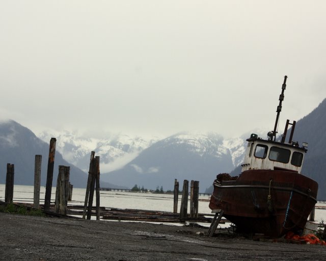
45 miles after turning onto the Cassiar Highway, we took a detour to the west toward salt water, a big change from the inland terrain we’ve traversed since leaving home. We headed down (in elevation) highway 37A toward Stewart, B.C. and Hyder, Alaska, tiny “twin” towns that meet at the Canadian/U.S. border on a small bit of land adjacent to the Portland Canal. The Portland Canal is the 4th longest fjord in North America, stretching 85 miles from the coast into the interior. Here at the end of the canal, it’s only about ¼ mile wide, and from the look of the map, never gets much wider. Check out our “Spot” tab above and click on today’s location message to view a Google earth map of the area.


This area is slightly north of Ketchikan, AK but not connected by any roads. This is where Alaska begins to cut off the northern half of British Columbia and all of the Yukon Territory from the Pacific coast. On highway 37A we drove past our first glacier sighting, of Bear Glacier, which begins high in an adjacent mountain and ends at the river next to the highway at 1,400 feet of elevation. We’ll be seeing lots of “bigger and better” glaciers over the next few weeks, but this was our first and it was blue and beautiful!


At the end of Highway 37A we entered Stewart, B.C. and 2 miles later crossed the “border” into Hyder, AK. There’s a small structure on each side of the road designating the border, but only the Canadian building was staffed by a nice man who asked a few questions, looked at Cathryn’s I.D., and waved us along. The U.S. post was closed. More on these two towns and this area tomorrow, as we plan to stay here two nights to explore. We’re ready for a day off from driving, and the campsite we’re in at Bear River RV Park is pretty, inexpensive, and has full hook-ups (a first on this trip) as well as wi-fi right at our site.


We drove 305 miles today, making our total mileage about 1,100 since leaving home. The scenery is gorgeous, has changed from the rural-but-still-developed feel of lower B.C., and the terrain has begun to exhibit the “wild and vast” feel described in the books.

Wednesday, May 19, 2010

Gettin' There

 
We’re in Burns Lake, British Columbia, halfway between Prince George (which is pretty much in the geographic center of B.C., and its’ 4th largest city with a population of 80,000) and Prince Rupert, the last coastal city in B.C. before you enter South East Alaska, a strip of land that blocks access to the Pacific for the northern half of B.C. So far we’d characterize our first three days of travel as just “getting’ there”, despite the gorgeous scenery through the Fraser Valley and the fun afternoon and evening with Chris and Carl in Brisle. We’ve been focusing on putting in the miles. Starting tomorrow we really begin to be tourists, seeing our first glacier, and maybe some life a bit wilder than the white tail deer that we’ve seen so far.

Other than our trip up the Inside Passage last August on the 60-foot trawler, “Gold Rush” with friends Greg and Terry (ending in Ketchikan, AK), neither of us has been anywhere in B.C. outside Vancouver, the lower half of Vancouver Island, the Whistler ski area and the area just north of the border including Banff, Jasper and Lake Louise. The interior of B.C. is quite different. Most of it is between 1,500 and 2,500 feet in elevation with a mix of forest, pasture, meadows and farm land. The economy is definitely resource-based, with timber and pulp being the largest commodities, but there are also several copper and gold mines. There are many, many lakes, big and small, so during the season there are lots of folks up here for fishing, boating and other recreation. To give you some hint about the weather up here, we read that Prince George has an average of 85 frost-free days a year, and an average summer high of 68 degrees! With the exception of Cache Creek, where we experienced 80+ degrees, our days have been in the mid to low 60s so far. There is something about the landscape that just looks “cool”.

The towns we’ve passed through all look like working cities, not particularly affluent, but less depressed than some of the more resource-based towns in our home state of Washington. Maybe it’s the Canadian approach to land use regulation that just makes it look more compact, even though Wal-Mart and fast food is just as well represented as in the States.

Gas prices seem high to us: $1.09 per liter or $4.13 a gallon if we’ve done the conversion correctly. So far we have used 83 gallons of gas since leaving home. Dragging a trailer is not a fuel-efficient way to travel, despite the significant savings over staying in motels and eating 3 meals daily in restaurants. On the other hand, we used almost 700 gallons of diesel between Port Angeles and Ketchikan last year in “Gold Rush”. We still think the trailer is a great way to travel. We’ve only paid for camping one out of three nights so far, and haven’t eaten in a restaurant yet.

Tonight we’re at Hadley Beach Municipal Campground, right on the shoreline of Burns Lake. Free camping is allowed for up to 72 hours, and there’s a free dump station and potable water supply two blocks away for tourists(thank you Burns Rotary). There are loons on the lake, and only one other camper besides us. We drove another 340 miles today in 7+ hours and are looking forward to a significantly shorter day tomorrow, and a “no drive day” the next day while we explore Stewart, B.C. and Hyder, AK up the Portland Canal fjord from the coast slightly north of Ketchikan.

Pine Beetle


Folks like us who live in an urban area have vaguely heard about a problem in the forests with Pine Beetle infestation. For the last two hundred miles driving up the Fraser River Valley we’ve seen widespread evidence of this scourge. Every pine tree larger than 6 to 8 inches in diameter is dead! In many areas, this is well over 50% of all the trees, the dead pines standing starkly black off in the distance. We’re told we’ll continue to see this devastation for much of our trip.

The problem began 7-10 years ago. Conventional wisdom has it that the unseasonably warm winters with no extended period of 40 degrees below zero, resulted in the Pine Beetle not dying back as they had in the past. One more impact from our carbon addiction. The hope is that with the death of their entire habitat, the beetles will die back due to lack of food. In the meantime the forestry industry in British Colombia has been badly harmed and the landscape significantly altered.

Livin’ in the Woods

Who knew everything on this highway would be called “xxx-Mile House”? Not us. After leaving our Green Lake campground we drove 10 miles and re-connected with Highway 97 at 83 Mile House, drove past 89 Mile Ranch, passed through 100 Mile House to 108 Mile House. . . ok, you get the idea. This is a throwback to Gold Rush Days when lots of people traveled through, but nothing was surveyed, nowhere had addresses, and “place” was designated by how many miles up the highway you were, at the closest house. After 75 miles northbound, we left the highway again at 150 Mile House and headed off-route 40 miles to the northeast passing turnoffs to the towns of Horsefly and Likely, finally arriving at a place with no official name, but referred to as “Brisle” by the folks who live there.


“Brisle” is the 80-acre summer home of Carl and Chris, friends we met at Playa Juncalito in Baja, Mexico 2 winters ago, and re-connected again this past winter. Both winters we camped near them on the beach and had memorable, fun days with Carl on his sailboat out of Puerto Escondido. We also had a full day of fishing with Carl this past winter, shared numerous cocktail hours and a few meals. Carl bought this property 40 years ago and spent 20 years completing the log cabin, building it himself, by hand – cutting the trees from his property, peeling the logs, and building the entire house, hiring help only to put in the well. It remains off-grid, and has a propane refrigerator and stove, and an outhouse. Large solar panels are on the roof and nearby in the yard, along with a 1000-pound bank of batteries to provide power. They have satellite radio and TV, and no telephone. The cabin is light and airy, snug and warm, with beautiful views of the woods and hills to the south.


We arrived shortly after noon and spent the next few hours walking Carl and Chris’s property, and downhill to an adjacent lake where Carl keeps a 21-foot sailboat anchored, as well as seeing a number of neighboring properties. The closest grocery store is 24 miles away, and the Pub in Likely, the only restaurant, serves food 2 nights a week. Carl says the community holds a weekly “safety meeting” every Friday afternoon at the Pub. They frequently see black bear, moose, coyote, fox, deer and occasionally cougar on their property. Once a black bear appeared at their sliding glass door and placed his paws on the door while mauling the nearby hummingbird feeder. Trees surrounding their house are primarily spruce, douglas fir, poplar and some pine.

We drank Carl’s delicious, smooth, dark home-made beer for cocktail hour, and Chris made a wonderful puttanesca for dinner. It was great fun to see them in a different setting and tour their charming and very romantic home in the woods. We agreed they’ll come see us at our home the first week of November on their way back to Baja, Mexico. Day 2, another terrific day!

Tuesday, May 18, 2010

“Toto, we’re not in Kansas anymore.”

Or Olalla! The first day of our northbound journey toward Alaska was a day of contrasts in scenery and weather. We left Olalla before 7am under mostly sunny skies and cool-ish, pleasant temperatures. We crossed the border at Sumas about 11am with not even one car in line ahead of us, and after answering 15-20 questions: “Do you have any guns? Any weapons? Any fruits or vegetables? Any mace or pepper spray? Any bear spray?” (all are prohibited) and responding “No” to each, we were waved on our way in less than than 3 minutes. After turning onto Highway 1 just north of the border, we drove to Hope, B.C. and entered the very attractive Fraser Canyon which runs along the Fraser River for many kilometers, surrounded by abruptly tall mountains covered in evergreen trees, with snow still in the higher reaches. Canadian Pacific railroad tracks line both sides of the river, and we entered many tunnels through the rock along the way.

Temperatures rose as we meandered north, and to our surprise, by 2pm as we arrived at Cache Creek, hit 82 degrees. This section of B.C. is called “The Arizona of Canada” because its’ semi-arid weather is characterized by hot, dry summers and cold, dry winters. There are agricultural fields along the way, the trees thin out and the mountains shrink, and by 4pm we found ourselves in Clifton, B.C. where we planned to stay the night at a campground with wi-fi. Sadly this was not to be, as the campground was full. Dark clouds were building, so onward we went to the tiny town of 70 Mile House where we turned east off the highway to the Green Lake Provincial Recreation Area and a completely empty Arrowhead Campground on the shore of Green Lake.


About the time we left the highway it began raining lightly, then thunder followed, and by the time we picked our campsite it was raining full on with a stiff breeze and temperature of 62. We put in 8 ½ hours of drive time today, and covered 394 miles, periodically slowed by construction traffic and up to 15-minute stops on the highway. We expect this to be one of our highest mileage days of the entire trip. Nonetheless, we note how nice it is to have full-size highway lanes, shoulders, guard rails and amenities we grew accustomed to getting along without while traveling in Baja, Mexico the last two winters.

Today’s wildlife count: about a dozen white tailed deer and a dozen unidentified waterfowl.

Tuesday, May 18, 2010


We wouldn’t have guessed the concept of “Baja Midnight” (whereby all travelers in Baja, Mexico are in bed by 9pm, waking for sunrise between 5 and 6 am) would translate in Canada, but at least for us, it did. We went to bed at 9:15 last night after taping sheets of aluminum foil over the bedroom windows to make it dark, as suggested by one of the travel guides we’d read. We woke at 5am with full-on daylight outside, and 46 degrees, but 58 degrees inside the trailer, which quickly warmed to comfort with our heater. It doesn’t take much to raise the temperature in our 168 square foot home!


Tuesday, May 4, 2010

Power Outage

IMG_2268

We lost power yesterday around 4 PM and got it back about 10 AM this morning.   Good excuse for a  fire, and to go out to “Gate to India” for dinner.

Bob thought this log looked like the head of a Native American on a totem pole. Maybe it was the wine.

IMG_2267

Saturday, April 24, 2010

Sahu hi tithla

sahu hi tithla

This morning was cold and blustery on Colvos Passage where we live. We started a fire in the fireplace and settled in for a low-key day of reading books and watching the changes in weather out the window.

2010 2nd qtr

Around 10 AM we saw a Native American dug-out canoe working its way up the channel, moving along the buoy line about 100 feet off shore.  It was crewed by 11 folks, men and women, young and old, followed by a chase boat.

2010 2nd qtr1

Reminiscent of an earlier era.  Wish we know what “Sahu hi tithla “, the name of their boat, means.

Friday, April 16, 2010

Dumb Bird


A weird thing happened on our last run down the mountain as we headed back to our condo. Nancy and Kelly stopped downslope to wait for Bob and Cathryn to catch up, and noticed a Grouse slowly making its way over the snow, uphill, toward them. We stopped to watch the bird's progress, and pretty soon she approached our group. She walked in circles around each of us, coming within a foot or so, then took an intense interest in Nancy. For the next 10 minutes we watched this bird walk, in somewhat agitated fashion, around Nancy's skis and feet, pecking at her ski pole, attacking her ski pants and boots with her beak, and walking over the top of her boots. Nancy held out her hand to see if the bird would hop on, to no avail. The bird continued to appear agitated, and headed over to spend a couple minutes each with Kelly and Bob.  Finally, Bob moved to ski away, and the Grouse hopped on the back of Bob's ski briefly, as if to detain him or take a ride! What a weird bird! Or dumb bird, as some in our group described her. Tonight Nancy did an internet search to attempt to identify the bird, and decided it might be a Western Grouse. She also found a short video of a Grouse exhibiting exactly the same behavior, and it was described as an attempt to establish and protest it's territory. Live and learn.

Long Way From a Baja Beach

Having spent 4 1/2 months in Baja during this past winter, often on sunny, warm beaches, our current trip is priming us for the next adventure to Alaska.  Monday our friends Nancy and Kelly called to invite us to join them for a 3-day weekend at their condo in Whistler, B.C., a ski-in/ski-out ,two bedroom unit just above Blackcomb Village. We rescheduled a couple activities we had planned, packed our gear, and took off Thursday for the drive to Seattle to pick up Kelly and Nancy, followed by 4 1/2 hours to Whistler. 

P1020119

This morning dawned with sunny, blue skies, contrary to the weather report we’d seen that suggested we’d be skiing in the rain.  Kelly and Nancy knew the temps were below freezing last night, so suggested we wait til 10am to begin skiing so the ice would have a chance to thaw and make the snow surface better for skiing.  That turned out to be great advice!  So we spent 5 hours riding chairs up the mountain and winding our way down gorgeous ski slopes with spectacular views of the Coast Range. 

P1020120

Nancy and Kelly are far better and faster skiers than we are, neither of us having ever taken a lesson in our 30+ years of skiing.  After a few hours of skiing together they made one incredibly diplomatic suggestion to each of us for improving our form, and we found it was actually easy to focus on making ONE technical change!  Cathryn can no longer easily find Bob on the slopes by scanning for his strandard “stance” – he has a completely different look as a result of this one suggestion! We are grateful, as the thought of taking a “real” lesson, in which we’d undoubtedly get 18 suggestions regarding things we should do differently, would certainly result in absolute failure. 

It was a beautiful day, the snow conditions were great (for Spring, anyway), and it was so warm we were shedding layers throughout the day – fabulous!  Nancy and Kelly are easy, fun travel companions and we are so happy to have made this trip.  Tomorrow:  another day on the slopes!

Thursday, April 15, 2010

Staircase!


IMG_2214 a

It was a beautiful spring day today. Cathryn was busy with a variety of activities all day and had potluck dinner  plans with neighbor women, so Bob jumped at the chance when his sister Lynn called with a proposal to join David and her on a hike on the Staircase Trail in the Olympic National Park.

IMG_2224 a

Because it was early in the season, the road was closed at the west end of Lake Cushman, so we walked a mile on the road before hitting the trail. The water was high in the North Fork of the Skokomish River, so the Staircase Rapids were roaring! We made so many side trips down to the river along the rapids that by the time we arrived where the bridge across the river used to be, the GPS informed us we were only averaging 1 MPH!

IMG_2237

We had our lunch at the top of the trail, then returned the way we came until we got back to the road, where we took the Shady Lane Trail along the south side of the river at the head of the lake where we rejoined the road, and made our way back to the car.

A great way to spend a sunny spring day!

Wednesday, April 14, 2010

Alaska: The Plan

bearglacier[1]

OK, we’ve put The Plan to paper and drawn it on a map. We know we won’t follow The Plan, because we never do, but we wanted to see if we could really “do” a trip to Alaska in only 6 weeks. It looks like we can, although we’ll leave lots of things for a second or third trip. It’s like trying to see most of the lower 48 in 6 weeks (it’s actually similar mileage) . . . it can’t be done.

We laid it out as if we were going to do the full trip in 38 days. We know we have at least a couple of days of driving that may be too long, and we’re sure we’ll find places we just have to spend another day. But we actually have about 45 days available for the trip, so we have the ability to add days when we want to or need to.

We’ve put a map in the right-hand column showing the route (double click on it to enlarge the map) and added a tab or “page” just under the header picture that has a text copy of the itinerary. We’d love to hear from anyone who has made a trip to Alaska if you have suggestions on things to do or see, places to stay, or places to eat along our route.

We plan to leave Monday, May 17th and return the 1st of July. July, August and September are the three months in which the weather is dependably great on Puget Sound, and we want to be home for the peak of the boating season.

Wednesday, March 31, 2010

Home Sweet Home

Home, Sweet Home!

IMG_2198

Well, if it weren’t that we’re already busy planning our next road trip in the Arctic Fox, to drive to Alaska beginning the third week of May, we MIGHT be a little sorry we came home so early! We arrived last Thursday and woke up multiple times during the night to the sound of rain pounding on the bedroom skylight. The next day was actually sunny and mild, and Bob was able to mow the lawn, but by Sunday morning the weather deteriorated significantly. We woke at 5am to a completely dark house – the power was out – with high winds and hard rain, even some hailstones.

IMG_2197

Turns out a tree had fallen on the electrical lines on the road coming down the hill to our house. So we lit candles and the fireplace, then got dressed and headed to the YMCA for coffee, exercise, warmth and hot showers. By 10:30 am power was restored. So we’re busy emptying and cleaning the Fox, re-stocking, seeing family, friends and neighbors, and reading Mike and Terri Church’s book on camping in Alaska, among other sources of information. In truth, we’re happy to be home. But Baja was a wonderful place to spend a second winter!

Wednesday, March 24, 2010

Almost Home!

We gathered with Jim and Jan for coffee in our trailer for half an hour this morning, then said our goodbyes. It was wonderful to see them again, and we’re eager to make it work to see them in May on our way to Alaska.

We left Kalamath Falls at 8am and headed west only 90 minutes to our first stop for the day. Our daughter Mackenzie is married to Matt, who grew up in Medford, Oregon. Both of his parents still live there, and we haven’t seen them in quite awhile. We met Matt’s father Bob at a coffee shop at 9:30 and had a nice hour-and-a-half visit, catching up a bit on our travels, his work and other family activities. We then moved on to gas up the truck and pick up Matt’s mother Jeri at her office. We had lunch at a nearby café and had more conversation about travels, our kids and family. They’re expecting their first grandchild in Seattle this summer (Matt’s brother and his wife) so we won’t be surprised if we see them in our area more often starting then! It was nice to catch up and we were pleased they could take time out of their busy work days to visit with us.

We left Medford at 1:00 uncertain how far we’d go, and by 5:00 in Corvallis, OR we were tired and ready to pull off I-5. We arrived at our campground under sunny skies with a temp of 70, so spent a very nice hour sitting outside and reviewing the past 3 months, reminiscing about how much fun we’ve had! So this is our last night in the Arctic Fox for awhile.

Tomorrow we’ll be home by mid-afternoon! We can’t wait to see family and friends again and start planning the next adventure to Alaska beginning the third week of May. We don’t generally post to our blog except when we’re traveling, though occasionally a photo or two gets added, but we hope you’ll join us again in May as we drive up through British Columbia and the Northwest Territories of Canada, then into Alaska for our first 6-week trip there. We’ve been getting some great tips on traveling to Alaska from one of our blog readers we’ve never met before. They will be Camp Hosts on the Kenai Peninsula for the summer, so if we get that far, we hope to meet them. It’s wonderful how a blog can bring people together. Happy travels!

Tuesday, March 23, 2010

A Reunion


During 8 hours of driving today we covered only 333 miles – another long enough day. We were on interstate 80 for an hour, and otherwise were on 2-lane winding highways that meandered through less elevation change than yesterday, but still made for slow going. Fortunately, the scenery was mostly beautiful!

winter-lake-tahoe[1]

The highlight of today’s drive was the west shore of Lake Tahoe which Bob had seen before, but was new territory for Cathryn. There was 3-5 feet of snow on the ground, but the road was bare and dry. One highway we’d planned to travel was still closed for the winter season due to snow, so we had to travel 40 miles out of our way on another road, but otherwise the trip was uneventful.

We were on a mission to get to Klamath Falls, Oregon today. For those of you who read our blog during our Baja travels a year ago, you may recall we met a couple, Jan and Jim from Penticton, British Columbia who we ended up traveling with quite a bit of the time because “there’s only one road!” and besides, we liked each other. Jan and Jim didn’t return to Baja this winter, as they spent time in New Zealand in the late Fall, then went to Arizona for the month of February.

IMG_2191

Via email, we learned we were both traveling north through California in the same timeframe and vowed to meet up if possible. Yesterday as we were pulling out of Death Valley and finally got a cell signal again, there were two messages from Jan telling us they were in Redding, California and urging us to join them. We were on the west side of the Sierras instead, but agreed to meet in Klamath Falls this afternoon!

So, we arrived about 4pm to find they’d secured adjacent spots in the campground and spent the rest of today together, a very happy reunion. We talked and talked and talked over beer and appetizers outside our trailers for 3 hours, toured each other’s rigs (both new since last winter) and then went to: where else, but a Mexican restaurant for dinner! We returned to our trailer together for a pre-bedtime cup of tea and more talking, then finally at 9:45 declared it “Baja Midnight” and headed to bed. We had a wonderful time catching up, and agreed to visit them in Penticton on our way to Alaska in May!

IMG_2192

Monday, March 22, 2010

A Roller Coaster Ride

Today we put in 10 hours on the highway, and during that time, gained 17,000 feet of elevation and lost 12,000 feet. No, we were not in Alaska driving up Denali; we were on the east side of the Sierra Mountains in southern and central California! We left Death Valley at 8am and immediately climbed 5,100 feet to the top of Towne Pass, then began a precipitous drop of 3,600 feet, followed by another 4,000 foot climb. The pattern continued throughout the day with gains of 2 – 3,000 feet and drops of similar depth. Our Chevy Silverado 1500 put in a good, hard day, and so did our brakes! Only once did our “Check Engine” light come on, and only once did we stop for a 15-minute break because we could smell our brakes.

We stopped for lunch in Bishop, California at a bakery and lunch deli recommended by our friend Hobie, who has traveled and camped throughout California many times. We had a delicious sandwich and bought a loaf of fresh-baked bread to get us through the trip home.

IMG_2182

The highlight of the day was a stop at Mono Lake on the opposite (east) side of the Sierra Mountains from Yosemite National Park. Mono Lake is at the foot of a drainage basin which collects water from numerous mountain ranges in the vicinity and has no outlets, so is a “closed ecosystem”. Its’ water is 2.5 times as salty as the ocean, and 100 times as alkaline. The water, though crystal clear, appears blurry, as if oil had been poured into water, the result of fresh water springs that bubble up into the salty lake water. The most astonishing feature is the many formations called “Tufa Towers” which line the shore and spring up from the water’s surface. We’ll let the park signage explaining these formations tell their story.

IMG_2168


The water level in the lake is now more than 30 feet below historic levels, as the City of Los Angeles began draining water from several of its tributaries in 1949. In 1994 an agreement was reached to limit those water withdrawals, and a goal was set to replenish the water level to only 25 feet below historic levels. In the 16 years since, it has not yet achieved that goal. This is significant because the Tufa Towers stop growing when the water level drops below their locations, and the brine shrimp and alkaline flies that are the predominant residents of the lake suffer huge population losses. The area is surrounded by snow-covered mountains that loom as high as 9,000 feet, and today there was snow along the shores of the lake. A beautiful sunny day, though cold enough that Bob donned jeans for the first time since early January when we left home.

IMG_2186

We spent about an hour at Mono Lake, then continued north on Highway 395 which meanders briefly into Nevada, thus leading to our overnight stop in Carson City, where we’re in an RV camp outside a Casino. We picked this one because it has both cell service and internet, two features we lacked access to while in Death Valley. Tomorrow we head into Oregon!

IMG_2185

A Day in the Canyons

This morning we drove 23 miles north to Stove Pipe Wells and up a gravel road 2 more miles and 1000 feet in elevation. We parked the truck and began a hike up Mosaic Canyon. The first half mile of the hike was an extremely narrow canyon, lined by polished marble.

IMG_2092 

A number of spots required a bit of scrambling, and we admit we missed the high-friction granite on which we’re accustomed to climbing at home and in Baja, as the slick marble is more akin to ice. At one point while Bob was clambering up a short, steep slope and juggling his camera to prevent its’ banging against the rock, he lost his footing and slipped 3 feet. We missed a great photo opportunity: on the slide, Bob hooked his right ring finger on a rock and bent it 45 degrees sideways, at the second joint. What a photo that would have been! Bob yanked the dislocated joint back into alignment, and it’s now swollen, a little sore, and a pale green shade, but frankly we expected worse. Following some ibuprofen and ice, he’s managing just fine as long as Cathryn doesn’t grab it to hold hands.

IMG_2094

We continued up the canyon 2 miles for another 1000’ feet of gain and many great views of sedimentary and other types of rock.

IMG_2102

We returned to our campsite for lunch, then traveled 15 miles south to the Natural Bridge. This is a short hike, or walk really, half a mile up a canyon to a natural rock bridge. Unlike the natural bridges we’ve seen at places such as Arches National Park in Utah, this one is made entirely of sedimentary rock. Suffice it to say we walked rapidly while underneath.

IMG_2112

We again returned to our campsite for dinner, then packed a small water bottle with wine and headed up to Zabriskie Point on the east rim of Death Valley to watch the sunset.

IMG_2157

IMG_2158

Zabriskie Point is the singular most spectacular site in Death Valley as far as we’re concerned. If you were only going to see one place here, this is it. We saw it last year when we were here with Adrienne and were eager to return. It’s been overcast all day, and as a result the colors in the rocks have not been quite as vivid as they were last year, but it’s still an awesome place.

IMG_2162

We’re headed north tomorrow. Not sure where exactly, maybe Lake Tahoe. Check our SPOT (see the right-hand column) to find out where we end up.

Sunday, March 21, 2010

Back to Death Valley

Last year on our  journey home from Baja, during this same week of March, our daughter Adrienne flew into Las Vegas where we picked her up and traveled to Joshua Tree and Death Valley, California for her spring break. We only allocated 1 ½ days to Death Valley and decided there was too much we were unable to see, so wanted to return to round out our explorations.

IMG_2074

We left Palm Springs under sunny skies and drove 6 hours north, ending with an unsettling descent into Death Valley which included a 17-mile stretch in which the road rapidly loses 5,000 feet of elevation. We recalled our own 2007 experience losing brakes coming down a volcano in Costa Rica, in which we finally crashed the car to prevent going over a cliff instead (with 6 of us inside), as well as our son Ryan’s story about his second set of parents who lost their brakes while driving a motorhome down this same hill into Death Valley some years ago. They eventually stopped when the descent ended after 7 terrifying miles, if we recall the details correctly. So . . . halfway down the slope, Bob pulled to the side and stopped our vehicle for 10 minutes to allow the brakes to cool off before proceeding. We can only imagine how hard the truck’s engine will have to work to pull our Arctic Fox back up that same hill in another day or two! In general, our Chevy 1500 truck and 7000 lb (fully loaded) fifth wheel trailer are pretty well matched, but when it comes to extended uphill grades, that truck works pretty hard!

IMG_2073

After settling into our campsite at Furnace Creek, we went to the nearby Visitor’s Center for a map of Death Valley National Park and some recommendations about what to see. As it was already late in the day, we went on a drive of the aptly named Artist’s Palette loop, about 9 miles through multi-hued volcanic and sedimentary rock hills. Because of this year’s wet winter in southern California, there’s actually surface water in the usually dry lake-bed. We’re sad to report that for the second year in a row we’ve missed the spring wildflowers. Maybe next time!

IMG_2079-1

After dinner back in our campsite, we returned to the Visitor’s Center to listen to a hugely enthusiastic Camp Ranger Geologist give a talk on the history and geology of Death Valley that included lots of verbal “exclamation points”. It was a story which makes this place all the more astonishing to contemplate.

Tomorrow we’ll do some hiking. Meanwhile, we’re glad we returned.

Friday, March 19, 2010

A Day of Contrasts


Contrast l: Last Friday we were on Playa Requeson on the IMG_1771

IMG_2050

Bahia Concepcion in Baja; today we were at 8,600 feet on Mount San Jacinto in Palm Springs, California. When we left the valley at 10:30am, it was 80 degrees; 10 minutes later it was 45 degrees, and on the north side of the mountain, much colder when the wind chill was factored in. And there was SNOW on the ground! It was just as beautiful as Playa Requeson, but so, so different. The trip up the mountain on the Palm Springs Tramway was great! This tramway claims to have a greater elevation gain than any other in the world. We’ll admit it did feel like there was more exposure than on the tramway up Table Mountain in Cape Town, South Africa which we rode a year and a half ago. There was also a real “bounce and sway” to the car each time it traveled over one of the five towers on the way up. The scenery was spectacular.

IMG_2044

Contrast II: We traveled down from Mount San Jacinto about 1pm and drove 5 miles south to the Tahquitz Canyon Visitors Center on the Cahuilla Indian Reservation. From there, we took a 2-mile hike up to a waterfall at the head of the canyon. This hike through the desert canyon was an amazing contrast to the alpine meadows we’d walked through 7,000 feet above, just hours before. The canyon was gorgeous, filled with beautiful rocks and a burbling stream the whole way up.

2010 baja usa4

Contrast III: We just spent three months living with a mixture of gringo snowbirds (mostly retired married couples, with a smattering of loner men) and very traditional Mexicans, from conservative families to macho men (sometimes a little too macho for Cathryn’s liking). This afternoon we sat in a sidewalk bar on Palm Canyon Drive in downtown Palm Springs and found we were in a distinct minority as straight couple. We just didn’t see many gay folks while in Mexico, so Palm Springs, with a strong gay presence, was an interesting contrast to our experience in recent months.

We tried to sign up for a tour of famous (for their architects, not their owners) mid-century modern homes, but the tours were filled for the next 10 days, as it seems to be spring break here, a detail we’d not anticipated. Instead, we drove our truck around the northwest part of Palm Springs through a gorgeous neighborhood filled with ranch style 1950s and 1960s homes with lovely walled gardens. Very nice.

We enjoyed the day. The contrasts made for interesting conversation while we explored this area. Tomorrow we leave for Death Valley. Should be fun.

IMG_2058